Log in
All resources
Create a design
219 Free Images of French Language Maps Of The World
bibliothèque nationale de france
atlas, ou représentation du monde universel et des parties d'icelui, faicte en tables et descriptions très amples et exactes, divisé en deux tomes. édition nouvelle... - btv1b53103889w
philippe buache
18th-century maps of antarctica
carte de barbarie, nigritie, guinée par guillaume delisle (1707)
bibliothèque nationale de france
hendrik de leth
1650s maps of the atlantic ocean
joan blaeu
jean-baptiste-henri delahaye
philippe buache
1836 maps of africa
ambroise tardieu
atlas, ou représentation du monde universel et des parties d'icelui, faicte en tables et descriptions très amples et exactes, divisé en deux tomes. édition nouvelle... - btv1b53103889w
maps of waldeck by gerardus mercator
atlas, ou représentation du monde universel et des parties d'icelui, faicte en tables et descriptions très amples et exactes, divisé en deux tomes. édition nouvelle... - btv1b53103889w
maps of guinea by mercator-hondius
atlas, ou représentation du monde universel et des parties d'icelui, faicte en tables et descriptions très amples et exactes, divisé en deux tomes. édition nouvelle... - btv1b53103889w
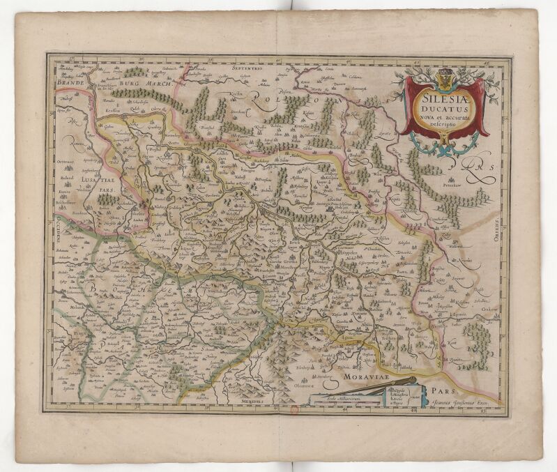
17th-century maps of silesia
atlas, ou représentation du monde universel et des parties d'icelui, faicte en tables et descriptions très amples et exactes, divisé en deux tomes. édition nouvelle... - btv1b53103889w
maps of the peloponnese by gerardus mercator
atlas, ou représentation du monde universel et des parties d'icelui, faicte en tables et descriptions très amples et exactes, divisé en deux tomes. édition nouvelle... - btv1b53103889w
maps of candia by ortelius and mercator
atlas, ou représentation du monde universel et des parties d'icelui, faicte en tables et descriptions très amples et exactes, divisé en deux tomes. édition nouvelle... - btv1b53103889w
17th-century maps of chile
carte de barbarie, nigritie, guinée par guillaume delisle (1707)
bibliothèque nationale de france
1690s maps of the ottoman empire
guillaume sanson
maps of the south atlantic
guillaume dheulland
18th-century maps of morocco
1700s maps of algeria
atlas minor gerardi mercatoris (1614, maps)
maps of liège by baptista van doetecum
18th-century maps of antarctica
1741 maps
maps of ancient israel by philippe de la rué
henri le roy (1579-)
claude auguste berey
henri liébaux
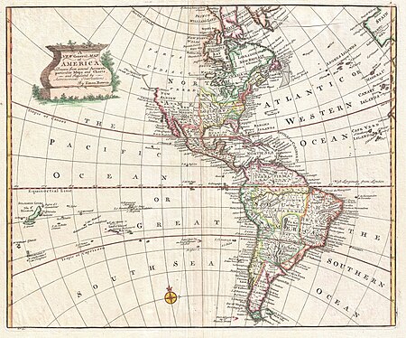
1740s maps of the americas
1747 maps of north america
201 - 219 of 219
/ 3


![Map of Thrace to aid in understanding Roman history / by Henri Liébaux, geographer; C[laude] A[uguste] De Berey, sculp[sit], Claude Auguste Berey, 1727](https://cdn.creazilla.com/illustrations/10001256073/map-of-thrace-to-aid-in-understanding-roman-history-by-henri-libaux-geographer-claude-auguste-de-berey-sculpsit-claude-auguste-berey-1727-md.jpg)